I posted earlier this week speculating about if we'd see any more chances for snow this spring, and threw in a large IF with that post. Well, it looks like we will see a bit of snow this weekend!
This one starts as rain this afternoon, which turns heavy in the early evening hours.
 |
| HRRR showing heavy rain in Southern New England early this evening (Tropical Tidbits) |
The transition to snow comes earliest in Northern New England, and occurs at around midnight for the western hill towns of Southern New England.
 |
| NAM showing snow in parts of New England around midnight (Tropical Tidbits) |
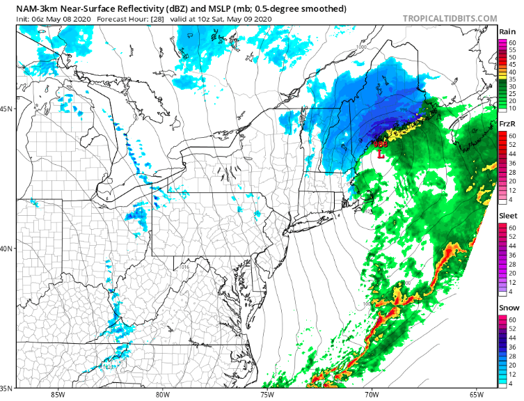
|
By Saturday morning when you're waking up, the snow will have worked its way into NH and Maine, dumping some heavy snow at times.
 |
| NAM showing heavy snow in Maine early Saturday morning (Tropical Tidbits) |
This storm is a pretty quick mover, and if you're a late riser and depending on where you live, you might not see anything accumulation-wise. When all is said and done, we'll be looking at a coating to 2 inches of snow for most areas, though portions of NH and Maine could see more significant accumulations. Here's what the National Weather Service is thinking accumulation-wise.
 |
| Forecasted snow totals (NWS Eastern Region) |
Temperatures will be impressively cold for May with this storm, and winds will be gusty during the day on Saturday. This storm is certainly exciting for May, and I'll unpack it when it's all said and done. If you have any photos of accumulation, send them in to be featured!


No comments:
Post a Comment